

You can find on this page the Boston streets map to print and to download in PDF. The Boston roads map presents the road network, main roads, routes and motorways of Boston in USA.
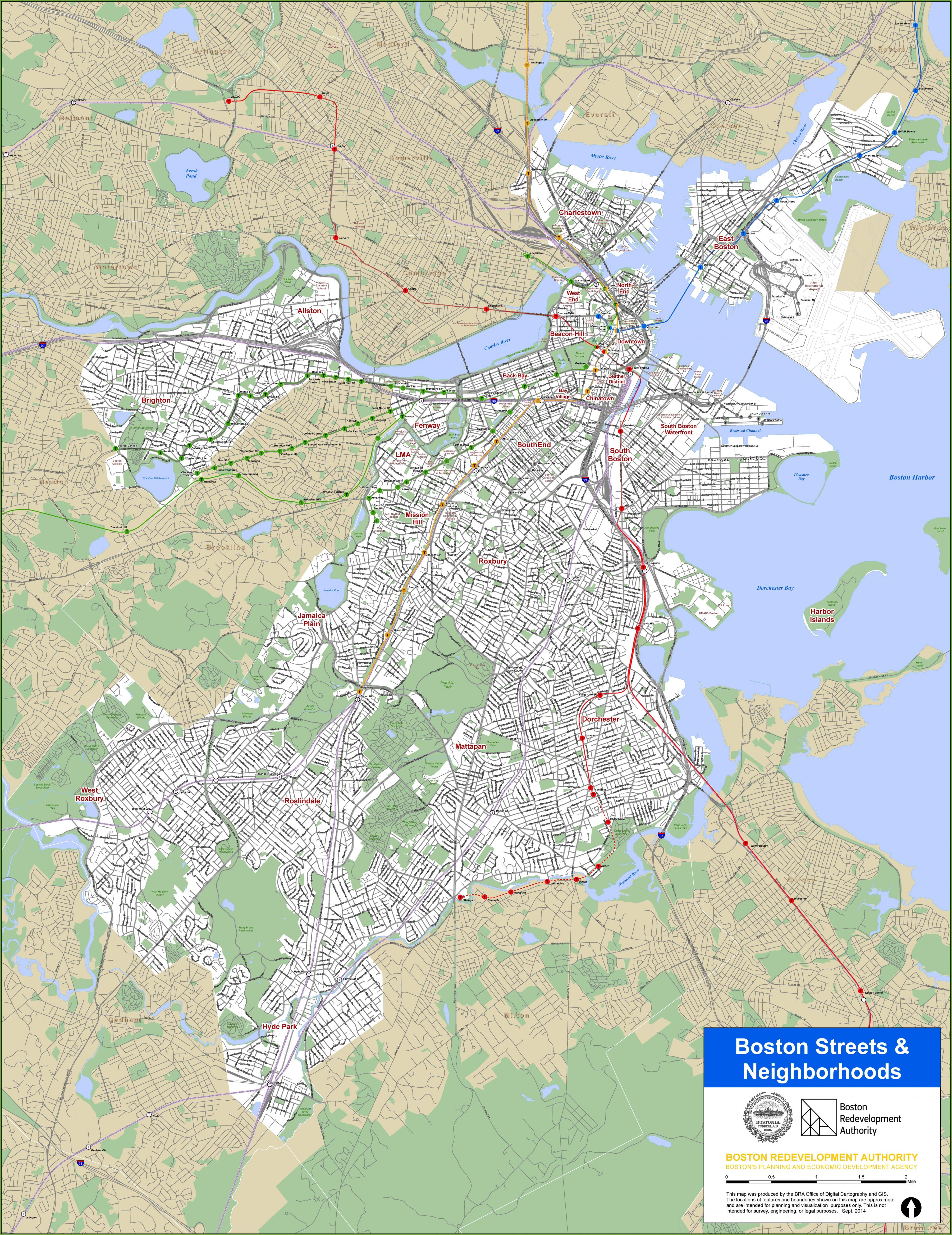
The Boston streets map shows all street network and main roads of Boston. This streets map of Boston will allow you to find your routes through the streets of Boston in USA. The Boston streets map is downloadable in PDF, printable and free.
The streets of Boston, may seem as though that they were not planned a common fiction is that streets evolved from old cowpaths, but in the 17th century Boston streets avoided swamps and marshes and followed shorelines (see Boston streets map ), Boston was expanded with landfill in the 19th century.
Boston downtown commercial Streets define Boston dense commercial core as its mentioned in Boston streets map. Boston Streets Types are found primarily in the Financial District, Government Center , Chinatown, the Leather District, Back Bay, and the South Boston Waterfront as you can see in the map.
Boston streets have developed their character over centuries of growth and evolution. Short, meandering streets in Boston historic areas such as the North End and Highland Park cede as its shown in Boston streets map to more generously scaled, 20th century treelined boulevards and streets in Boston.
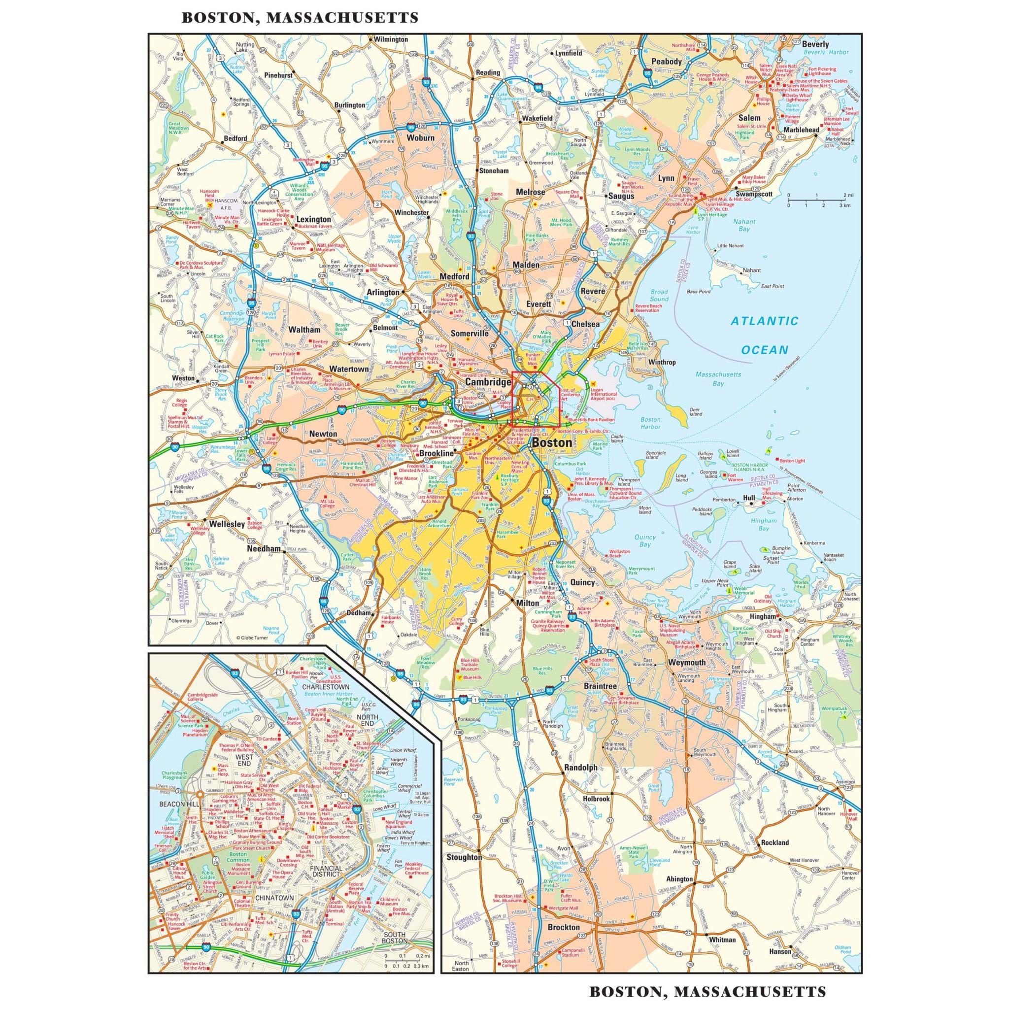
The Boston roads map shows all road network and highways of Boston. This roads map of Boston will allow you to find your routes through the roads and motorways of Boston in USA. The Boston roads map is downloadable in PDF, printable and free.
Boston roads change names and lose and add lanes seemingly at random, and many drivers in Boston roads are flummoxed by rotaries. Expressways and major arterial roads in and around Boston are laid out with two circumferential expressways: Interstate 495 and Route 128 as its shown in Boston roads map.
Traffic was bumper to bumper for six to eight hours per day, with projections of traffic jams doubling by 2010 (see Boston roads map). The elevated roads structure was decaying. For early 2000s, driving in Boston was disrupted by the Big Dig, the most expensive road project in the history of the US.
The Boston Post Road was the first postal route between Boston and New York , it became a portion of The King Highway, a 1,300-mile road ( see Boston roads map) laid out from 1650 to 1735 in the American colonies to link Charleston, South Car- olina, to Boston, on the order of Charles II of England.