

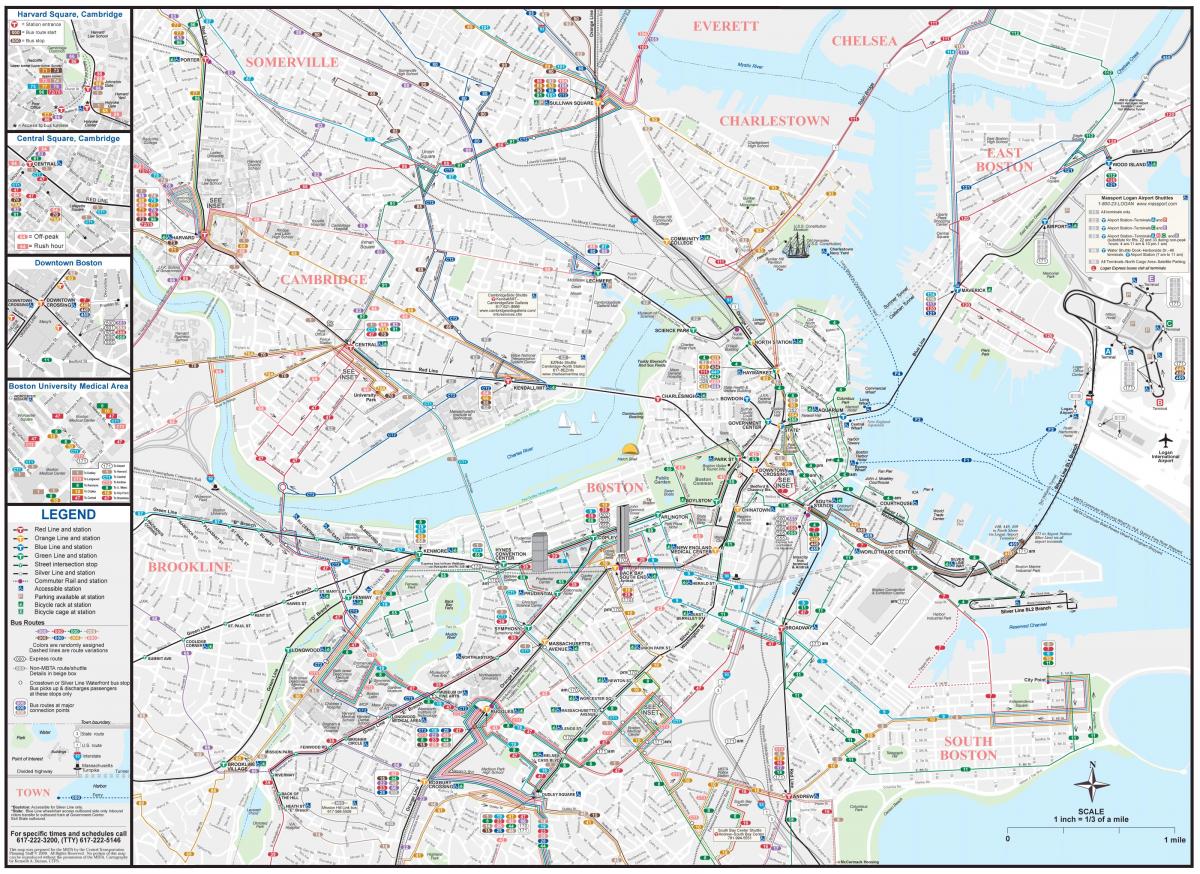
You can find on this page the Boston transport map to print and to download in PDF. The Boston transportation map presents the transports network and transport zones of the transit of Boston in USA.

The Boston transport map shows all means of transportation in Boston. This transports map of Boston will allow you to move easily with public transport of Boston in USA. The Boston transportation map is downloadable in PDF, printable and free.
The Boston transports system as its shown in Boston transports map includes roadways, rail, air, and sea options for passenger and freight transit. The Massport operates the Port of Boston, which includes a container shipping facility in South Boston , and Logan International Airport in East Boston.
The Massachusetts Bay Transports Authority ( MBTA ) operates services throughout Boston city and region as you can see in Boston transports map. Amtrak operates passenger rail service to and from major north eastern cities. Boston downtown areas and neighborhoods are accessible by public transports.
Boston transports system is operated by the Massachusetts Bay Transports Authority ( MBTA ) , but locals know it as the "T". Boston transports system offers subway, bus, trolley car and boat service to just about everywhere in the Greater Boston area and beyond as its shown in Boston transports map.

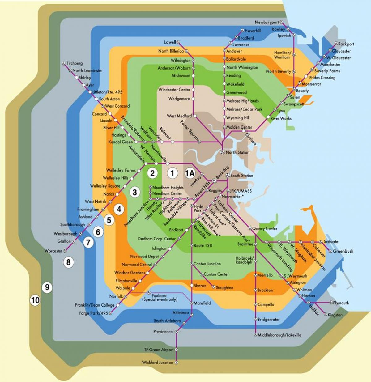
The Boston zone map shows all transport zones in Boston. This zone map of Boston will allow you to know the prices of public transport of Boston in USA. The Boston zones of transports map is downloadable in PDF, printable and free.
The Commuter Rail of Boston is divided into 11 fare zones, from Zone 1A to Zone 10. Stations as in metro Boston map are in Zone 1A, and every Zone beyond that indicates each station distance from Boston. The Commuter Rail fare depends on which Zones your boarding and exiting stations are located in.
A 1-way Zone 1A commuter rail fare is $2.40 wich serving Greater Boston, is the same as a CharlieCard subway fare ( the mud-brown color is used for zone 1A as its mentioned in Boston zone map). Bus Routes in Boston zones that stop at Lynn Station include Routes 426, 429, 435, 436, 441, 442, and 455.
Commuter Rail fares in Boston are based on a "Zone" and "Interzone" system with Zone 1A servicing the Greater Boston area and Zones 1 through 10 servicing communities and suburban areas outside of Boston as you can see in Boston zone map. Each Commuter Rail stations zone is identified in the chart.