

You can find on this page the Boston trains map to print and to download in PDF. The Boston trains map presents the rail network and railway stations of the trains of Boston in USA.

The Boston rails map shows all the railway stations and lines of Boston trains. This railway map of Boston will allow you to easily plan your route with the trains of Boston in USA. The Boston rails map is downloadable in PDF, printable and free.
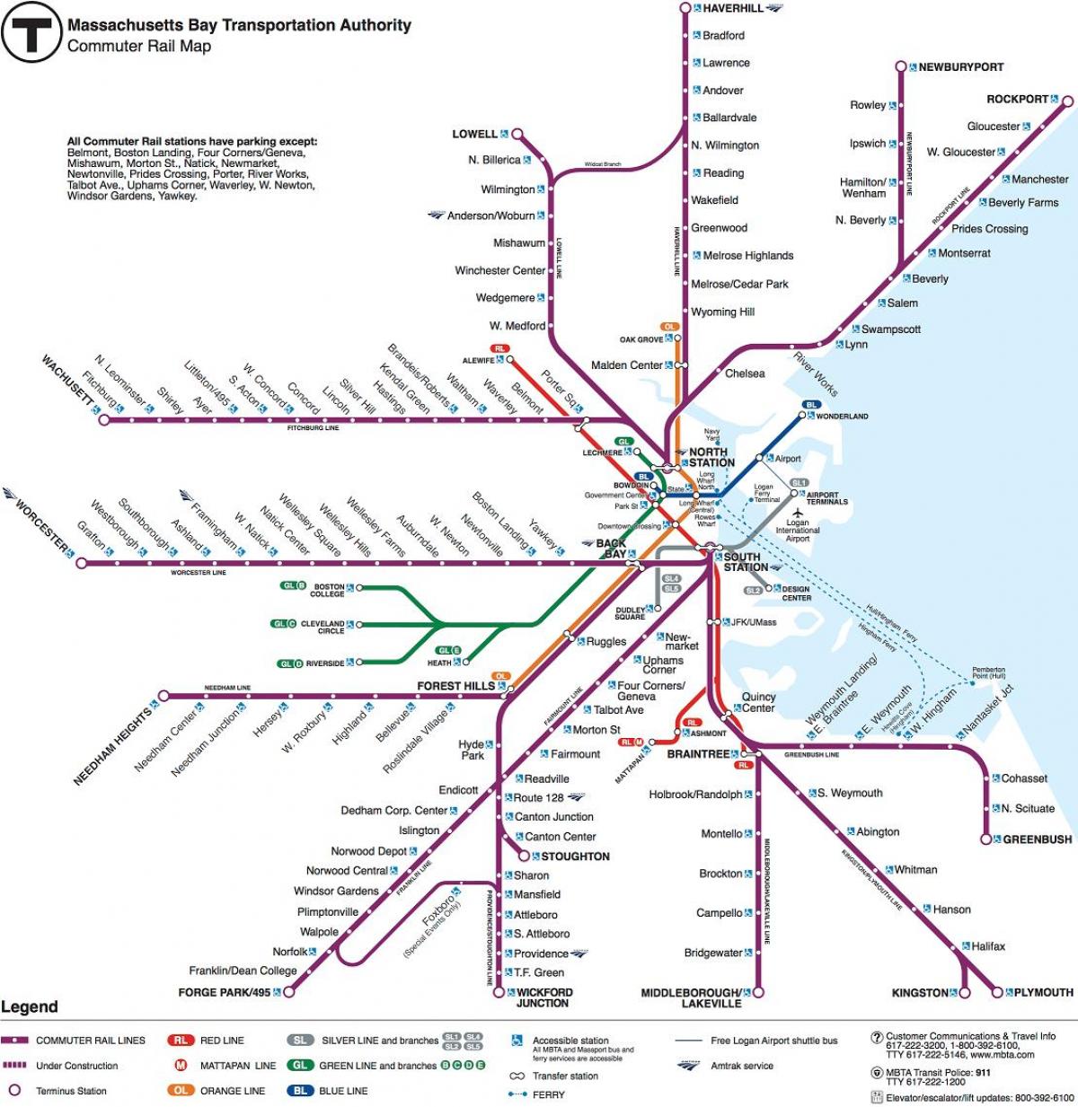
Boston has two discrete rail networks. First rail is the subway includes elements of light rail and streetcar operations. The second network forms the Boston area portion of the national common user railroad network, intercity passenger rail and freight rail services as its shown in Boston rail map.
MBTA Commuter Rail system, known as the Purple Line, brings people from as far away as Worcester and Providence, Rhode Island into Boston as its mentioned in Boston rail map. There are about 125,000 one-way trips on the commuter rail each day, making it the fifth-busiest commuter rail system in the country.
Boston is served by four intercity rail services, all operated by Amtrak ( see Boston rail map). The Acela Express and Northeast Regional services of Boston both operate on the Northeast Corridor to and from NYC and Washington. A branch of the Lake Shore Limited service operates to and from Chicago.